Product Description
Autel Alpha L35T Bundle
Key Features
- Visual/Thermal Wide & Tele Imaging
- Up to 1.25-Mile Laser Range-Finding
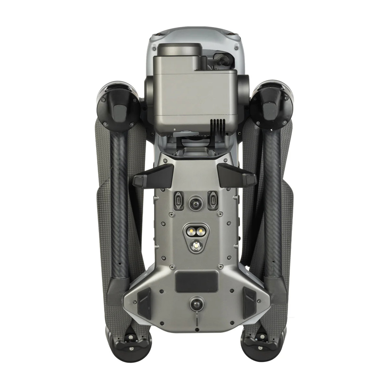
- 720° Visual & Radar Obstacle Avoidance
- Anti-Interference Technology
- A-Mesh Networking of Multi-Drone Fleets
- 4K Image & Video Capture
- Dual-Antenna RTK Millimeter Precision
- IP55-Rated Water & Dust Resistance
- Up to 40 Minutes of Flight Time
- Autel Smart Controller V3 Included
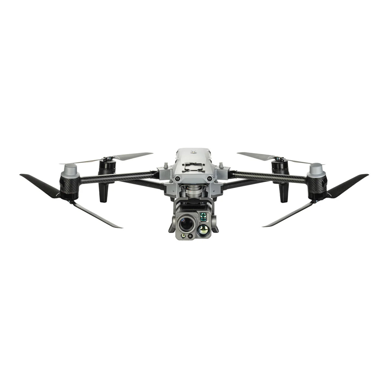
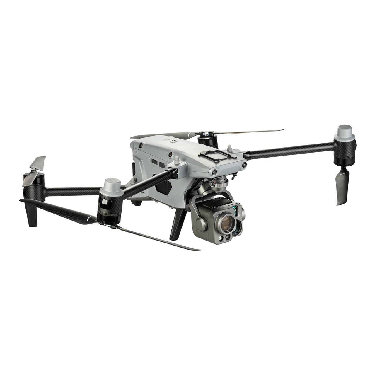
Alone or in a fleet, the Alpha Industrial Drone with 5-in-1 Gimbal from Autel Robotics offers law enforcement and industrial professions a wide range of imagine capabilities, along with the ability to fly safely, day or night, near critical equipment, and in adverse weather conditions. When it comes to imaging, the L35T gimbal offers five different abilities. You get both wide and telephoto visual capture up to 4K, wide and telephoto thermal imaging up to 1022°F, and laser rangefinder targeting up to 1.25 miles away. Flights are made safe with 720° omnidirectional obstacle avoidance, anti-interference technology, and dual-antenna millimeter-level RTK-based precise control.
5-in-1 Operation
- Visual (Wide): A 1/2" CMOS sensor offers 48MP image capture at a wide 84° diagonal field of view.
- Visual (Tele): Using an 8MP 1/1.8" CMOS sensor, you can capture images and video at up to 4K resolution, and with up to 35x optical and 560x digital zoom, you can do so for a comfortably safe distance.
- Thermal (Wide and Tele): With an uncooled VOx microbolometer sensor the wide thermal imager gives you a 13mm focal length for wide coverage, while the telephoto imager offers long-range capture with a 45mm focal length. Both will measure temperatures from -4 to 1022°F, capture those thermal images at 640 x 512 resolution, and allow for safe monitoring using a digital zoom up to 56x.
- Laser Rangefinder: Get an ultraprecise reading on targets at a range of 33' to 1.25 miles. Learn their distance, latitude, longitude, and height.
720-Degree Obstacle Avoidance
Anti-Interference
A-Mesh Fleet Networking
Autonomy Engine
Multi-Payload Platform
Skylink 3.0
- Quick: Create temporary quick missions as you are performing other missions. Multiple sub-missions can be stacked.
- Waypoint: Add waypoints for custom flight paths.
- Polygon: Quickly cover an area of interest with a polygon-shaped flight paths with a single click.
Smart Functions
- Tripod: This function locks the gimbal on a specific target as the Alpha hovers and automatically follows the target's movements, always keeping it centered in the frame.
- AI Target Recognition: Using Autel's AI recognition technology, this function will automatically identify and lock onto different types of targets, such as people, boats, and land vehicles. As it does this, the target's location is presented on the map.
Data Security
Additional Features
- Autel Enterprise app
- Return-to-home
- Manual control
- IP55-rated water and dust resistance
- Wind resistance up to 27 mph
- Hot-swappable dual battery operation
- Up to 40 minutes of flight time (no wind)
- Up to 56 mph flight speed (no wind near sea level)
- Create apps and integrate various accessories with Autel Mobile and Payload SDK
In-the-Box
- Autel Alpha Aircraft
- Autel L35T Camera & Gimbal x1
- Autel Alpha Intelligent Flight Battery Set (2 Batteries)
- Battery Charger x1
- Power Cable x1
- Propeller (pair) x3
- Gimbal Cover x1
- Repair Tool Kit x1
- Smart Controller v3 x1
- Smart Controller Lanyard x1
- Smart Controller Cover x1
- Smart Controller Spare Joystick (pair) x1
- RC Charger x1
- RC Charging Cable x1
- Data Cable x1
- 64G SD card x1
- Manuals
- Rugged Case x1
Specs
|
Maximum Horizontal Speed |
55.9 mph / 25 m/s |
|
Maximum Flight Time |
40 Minutes |
|
Sensing System |
Omnidirectional with Radar Enhancement |
|
Control Method |
Included Transmitter |
|
Maximum Operating Distance |
12.4 Miles / 20 km |
|
Mobile App Compatible |
No |
|
Weight |
13.98 lb / 6.34 kg (Takeoff) 18.5 lb / 8.4 kg (Maximum for Takeoff) |
Performance
|
Maximum Horizontal Speed |
55.9 mph / 25 m/s |
|
Maximum Ascent Speed |
33.6 mph / 15 m/s |
|
Maximum Descent Speed |
6.2 mph / 10 km/h |
|
Maximum Wind Resistance |
26.8 mph / 12 m/s |
|
Maximum Take-Off Altitude |
2.8 Miles / 4500 m |
|
Maximum Flight Time |
40 Minutes |
|
Maximum Hover Time |
38 Minutes |
|
Maximum Tilt Angle |
36° |
|
Hovering Accuracy |
RTK Horizontal: ±0.3' / 0.1 m Vertical: ±0.3' / 0.1 m GNSS Horizontal: ±1.0' / 0.3 m Vertical: ±1.0' / 0.3 m Vision Positioning Horizontal: ±0.49' / 0.15 m Vertical: ±0.3' / 0.1 m |
|
Maximum Angular Velocity |
300°/s (Pitch) 120°/s (Yaw) |
Aircraft
|
Rotor Configuration |
Quadcopter |
|
Remote ID |
No |
|
Built-In Video Light |
No |
|
Operating Temperature |
-4 to 122°F / -20 to 50°C |
Gimbal
|
Number of Axes |
3: Pitch (Tilt), Roll, Yaw (Pan) |
|
Rotation Range |
Mechanical Range Yaw (Pan): 180° (-135 to 45°) Pitch (Tilt): 120° (-60 to 60°) Roll: 180° (-90 to 90°) Controllable Range Yaw (Pan): 120° (-90 to 30°) |
|
Follow Speed |
Tilt: 100°/s |
|
Stabilization Accuracy |
±0.005° |
Avoidance/Sensing System
|
Sensing System |
Omnidirectional with Radar Enhancement |
|
Sensing System Capabilities |
Forward Detection Range: 0.7 to 101.7' / 0.2 to 31 m Field of View: 90° (Vertical) / 90° (Horizontal) Backward Detection Range: 0.7 to 101.7' / 0.2 to 31 m Field of View: 90° (Vertical) / 90° (Horizontal) Lateral Detection Range: 0.7 to 147.6' / 0.2 to 45 m Field of View: 90° (Vertical) / 90° (Horizontal) Upward Detection Range: 0.7 to 85.3' / 0.2 to 26 m Field of View: 90° (Front-to-Back) / 90° (Front-to-Back) Downward Detection Range: 0.49 to 164.0' / 0.15 to 50 m Field of View: 90° (Front-to-Back) / 90° (Front-to-Back) |
Remote Controller / Transmitter
|
Control Method |
Included Transmitter |
|
Operating Frequency |
0.9 GHz (902.000 to 928.000) 2.4 GHz (2.400 to 2.4835) 5.2 GHz (5.150 to 5.250) 5.8 GHz (5.725 to 5.850) |
|
Maximum Operating Distance |
12.4 Miles / 20 km |
|
Transmitter Power |
0.9 G: 30 dBm (FCC) 2.4 G: 30 dBm (FCC), 20 dBm (CE, SRRC) 5.1 G: 21 dBm (FCC) 5.8 G: 14 dBm (CE), 30 dBm (FCC), 33 dBm (SRRC) |
|
Transmitter I/O |
1x HDMI (Video) 1x USB-C (Data) 1x USB-A (Data) |
|
Clean Video Output |
Not Specified by Manufacturer |
|
Battery Type |
Built-In Lithium-Ion Polymer (LiPo) (5800 mAh) |
|
Wi-Fi |
Wi-Fi 5 (802.11ac); Dual-Band (2.4 & 5 GHz) with MU-MIMO Support (2 x 2) |
|
Bluetooth |
5.0 |
|
Mobile App Compatible |
No |
|
Built-In Display |
7.9" (2048 x 1536) Touchscreen LCD, 2000 nits/ cd/m2 |
|
Operating Temperature |
32 to 113°F / 0 to 45°C |
Flight Battery
|
Battery Chemistry |
Lithium-Ion Polymer (LiPo) |
|
Battery Capacity |
10,000 mAh / 237 Wh |
|
Battery Configuration |
6 S / 23.7 V |
|
Maximum Charging Power |
260 W |
|
Storage Temperature |
14 to 86°F / -10 to 30°C |
|
Charging Temperature |
50 to 113°F / 10 to 45°C |
|
Weight |
2.2 lb / 988 g |
Charger
|
Charger Input Power |
100 to 240 VAC, 50 / 60 Hz at 4 A |
|
Output Voltage |
26.4 V, 7 A |
|
Power Rating |
185 W |
General
|
GNSS Support |
GPS, GLONASS, BeiDou, Galileo |
|
Diagonal Size |
2.7' / 814 mm |
|
Overall Dimensions |
1.5 x 0.9 x 0.8' / 455.0 x 263.0 x 245.0 mm (Folded) 4.0 x 3.2 x 0.9' / 1205.0 x 980.0 x 278.0 mm (Unfolded) |
|
Weight |
13.98 lb / 6.34 kg (Takeoff) 18.5 lb / 8.4 kg (Maximum for Takeoff) |


